The QEA Methodology
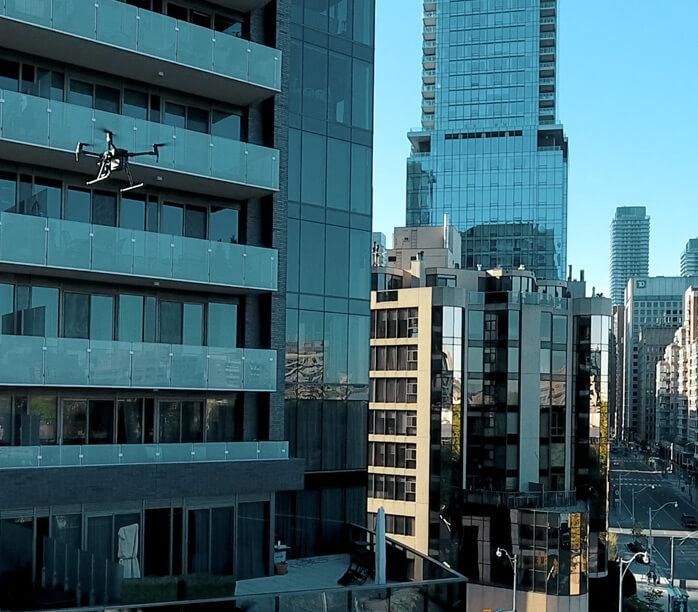
Precise imaging by autonomous drone Technology & pre-planned flight
- Precise Imaging
- Image processing
- Quantification
- Access method
The 4 Pillars of Visibility
Precise imaging by autonomous drone Technology & pre-planned flight
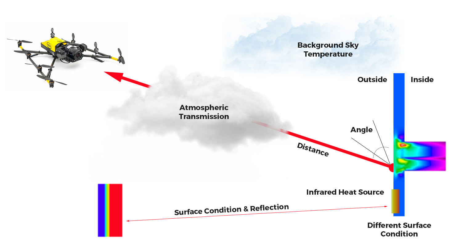
Various parameters have to be measured
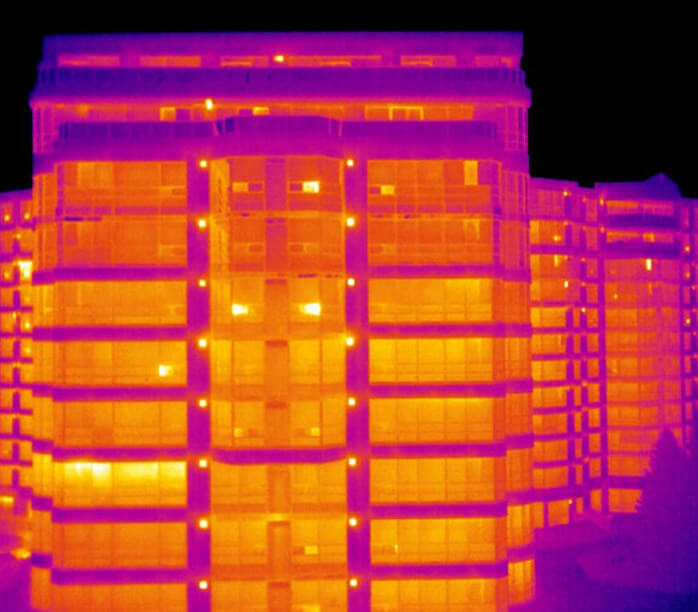
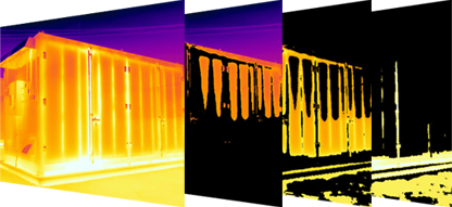
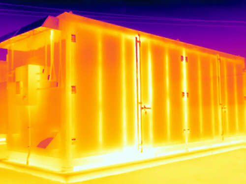
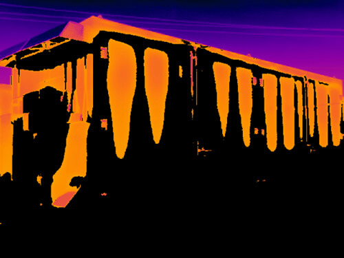
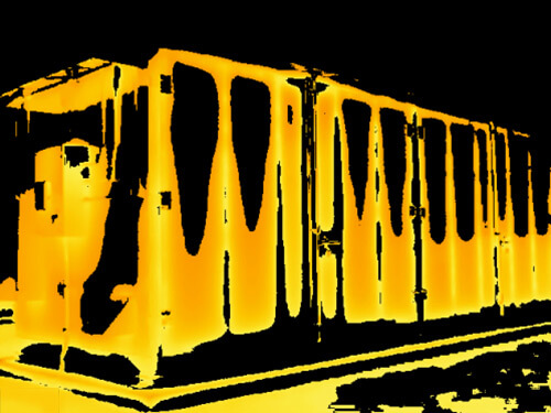
Precise Imaging & Image Processing are essential for applications like:
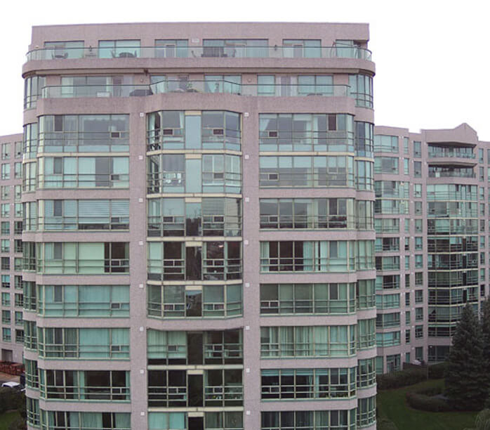
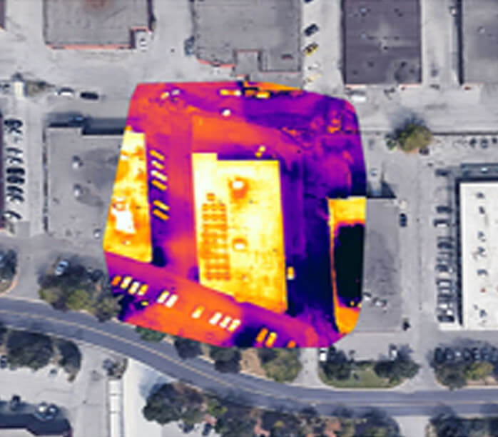
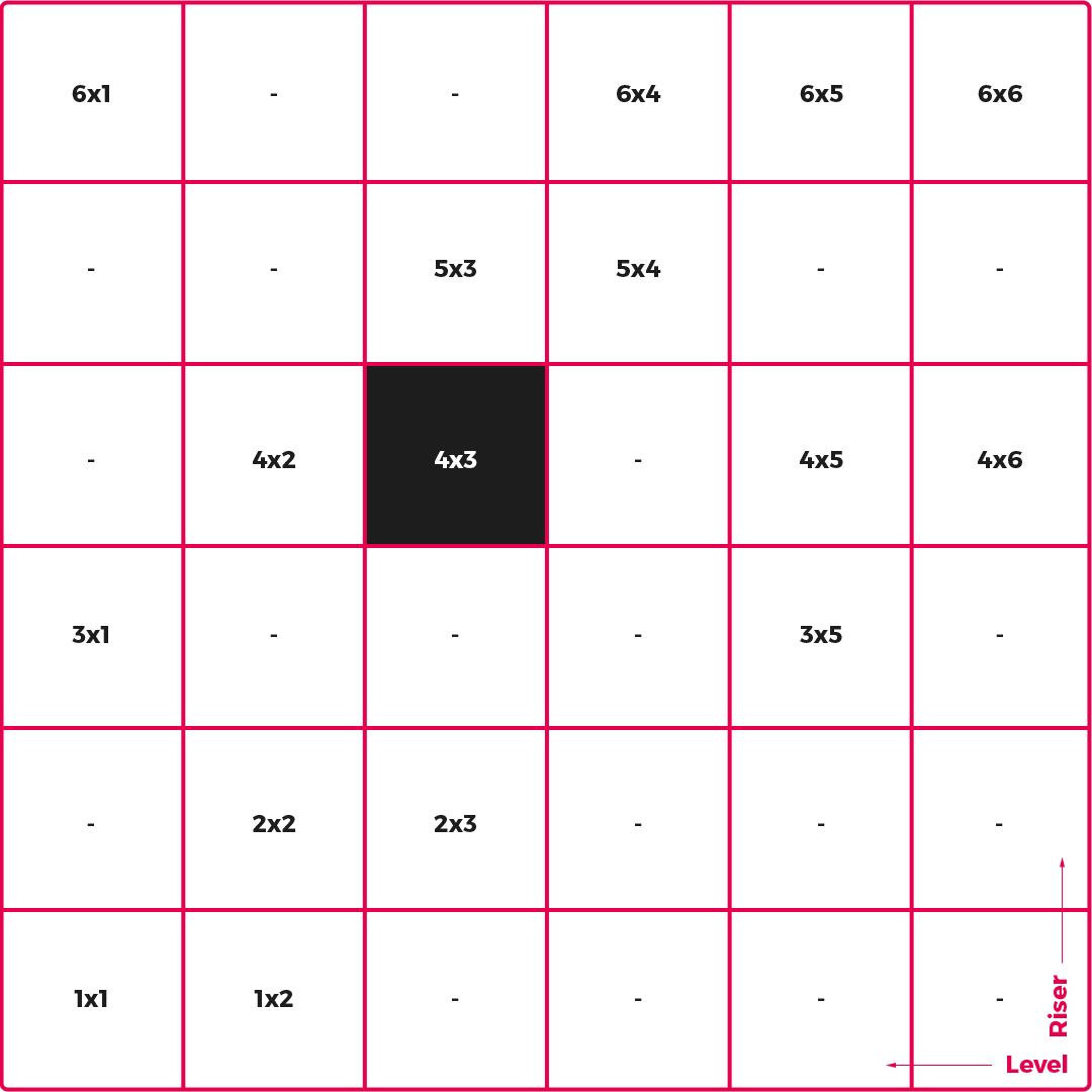
Can help to find the exact location of each image and define zone, riser, and level in buildings.
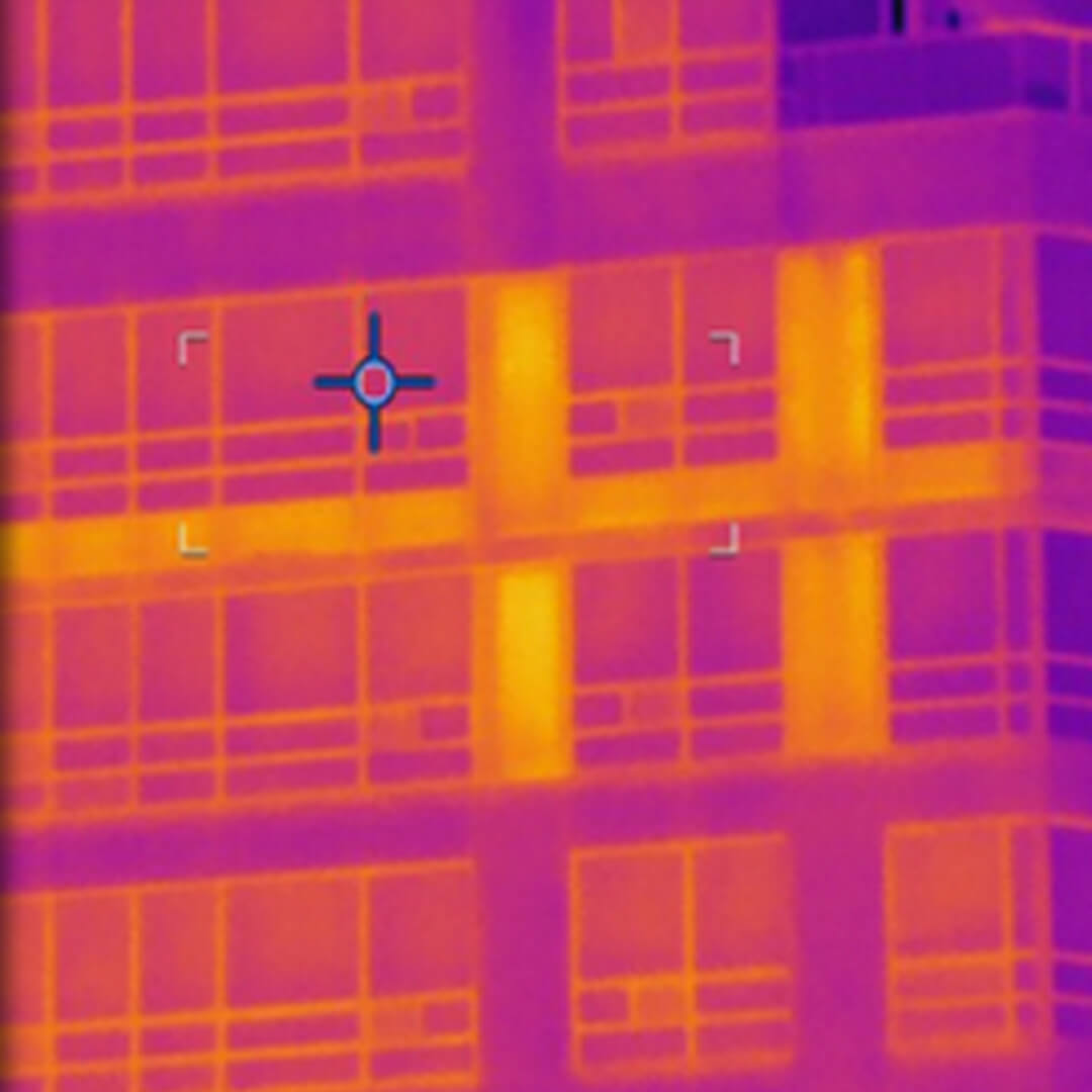
Precise Imaging & Image Processing for Indexed quantifiable (IQTM) Energy Audit

QEA Tech Quantification model is an analytical algorithm to creates, analyzes, and implements applications like Building Envelop Energy Loss, Urban Storm Management System, And Corona UV Emission In High Voltage Power Transition Lines.
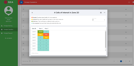
QEA Tech dashboard is a simple graphical user interface that provides at-a-glance views of selected images and reports relevant to a particular part of structures, infrastructures, and other assets.
![]()
© 2024 QEA Tech.