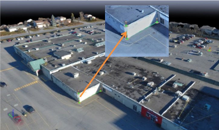
Our innovative technology produces 3D reconstructions of your assets with a positional accuracy of 5cms. The dataset captured by the drones at the points of interest is analyzed to extract useful information to build a photogrammetric model with geo-localization information. The speed, convenience and simplicity of the tool helps to navigate beyond the notion of cost-effectiveness. The high-resolution 3D model will serve as a knowledge base for your property and can be shared with your clients and stakeholders to make informative decisions. It’s a one-stop solution for versatile problems like volumetric calculations, topological applications, historical preservations etc.